
Llano Estacado: The Giant Tableland Beneath Lubbock That Most of Us Rarely Notice |
From Lubbock’s endless horizon to Palo Duro Canyon and the Caprock, the South Plains make more sense once you realize we live on top of one enormous elevated table |
Stand somewhere outside Lubbock on a clear evening and look toward the horizon.
There may be almost nothing between you and the setting sun.
No mountains.
Few trees.
No obvious ridge interrupting the view.
Just land, sky and a horizon that can seem impossibly far away.
That familiar West Texas landscape is not an accident.
Lubbock sits almost in the middle of the Llano Estacado — one of the largest and flattest elevated tablelands in North America.
Most of us simply call it the South Plains.
But understanding the giant piece of geography beneath us helps explain everything from our enormous skies and dramatic thunderstorms to the Caprock, Palo Duro Canyon, agriculture and even the history of the people and animals that once moved across these plains.
You’re Standing On It
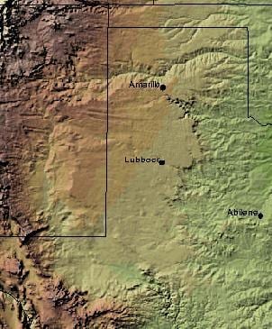
The Llano Estacado, commonly translated as the Staked Plains, stretches across northwest Texas and eastern New Mexico.
It covers roughly 32,000 square miles and forms the southern portion of the North American High Plains.
Lubbock sits squarely on top of it.
The tableland is bounded sharply in several directions.
To the east is the Caprock Escarpment, where the high plains suddenly give way to the lower Rolling Plains.
To the west, the Mescalero Escarpment drops toward the Pecos River valley in New Mexico.
The Canadian River cuts across the High Plains to the north, while the southern boundary gradually becomes less distinct.
The effect is something like an enormous elevated island of remarkably flat land.
|
Shaded-relief map of the Llano Estacado, derived from the U.S. Geological Survey National Map Viewer. Public domain. |
Flat — But Not Level
The Llano Estacado looks perfectly flat.
It isn’t.
The land gradually slopes downward toward the southeast at roughly 10 feet per mile.
That change is so gentle that you cannot see it happening.
Lubbock sits at an elevation of roughly 3,200 feet above sea level, while areas farther northwest toward eastern New Mexico rise above 4,000 feet and approach 5,000 feet along the higher western and northwestern margins.
Drive west long enough and you are climbing.
You simply do not feel like you are climbing.
That is part of what makes the Llano unusual.
A mountain announces itself.
The Llano Estacado quietly gains elevation for hundreds of miles.
Then Suddenly, the Table Ends
Anyone who has driven east from the South Plains toward places like Crosbyton, Dickens, Quitaque or the canyon country has experienced one of the Llano Estacado’s most dramatic features.
The land suddenly drops away.
That is the Caprock Escarpment.
In places, the escarpment creates a dramatic step between the high Llano and the lower country below.
Roads twist downward.
Drainages become deeper.
Mesas, ravines and exposed layers of rock replace the almost uninterrupted plain above.
This is the edge of our table.
And water has spent immense spans of time cutting into it.
Palo Duro Canyon Makes More Sense Once You Understand the Llano
Palo Duro Canyon can seem almost impossible when you first encounter it.
You travel across mile after mile of relatively flat Panhandle terrain — and then suddenly the earth opens.
Palo Duro was carved into the eastern edge of the High Plains by the Prairie Dog Town Fork of the Red River and its tributaries.
The canyon stretches roughly 120 miles and reaches depths of about 800 feet.
Caprock Canyons farther south tells much the same geological story.
These places are not geographic exceptions unrelated to the flat plains.
They exist because rivers and erosion have cut deeply into the edge of the Llano Estacado.
The canyons reveal what the flat surface above usually hides.
Why Does the Sky Feel So Big Here?
Visitors sometimes struggle to explain the scale of a West Texas sky.
Locals know exactly what they mean.
The Llano Estacado’s extreme flatness and scarcity of tall natural obstacles create an extraordinary field of view.
Storms can be watched from enormous distances.
Sunrises and sunsets seem to occupy half the horizon.
Cloud formations that might be partly hidden elsewhere appear almost theatrical here.
One local observation supplied for this story describes the sky as “tremendously huge” and says the storms have to be seen to be believed.
That sentiment will sound familiar to anyone who has watched a West Texas thunderstorm build from dozens of miles away.
|
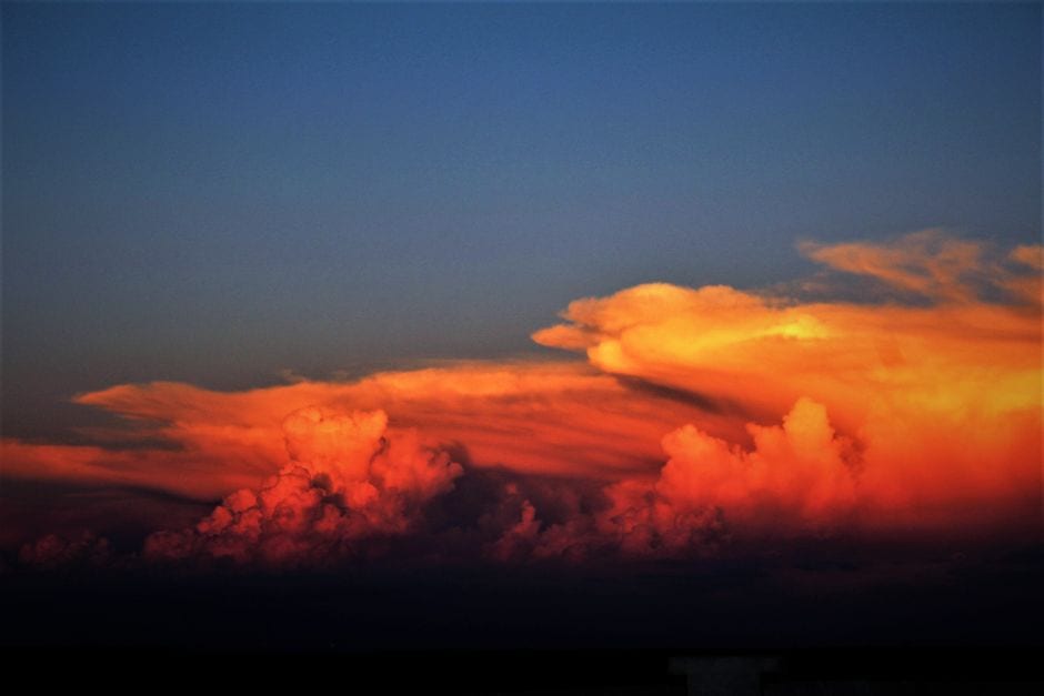 A Texas sunset illustrates the enormous field of view that makes High Plains skies feel so expansive. Photo by Georgia McFarland on Pexels |
Was the Llano Once Covered in Grass Tall Enough to Hide a Horse?
This is one of those stories that sounds right because descriptions of America’s original prairie often speak of extraordinarily tall grass.
And in some parts of the Great Plains, those descriptions were true.
But that image should not be applied to the entire Llano Estacado.
The historic High Plains around Lubbock were primarily shortgrass prairie, dominated in many places by species such as blue grama and buffalograss.
Sandy soils, drainage areas and wetter locations could support taller grasses, and the Southern High Plains contained a mixture of short- and mid-grass communities.
But the classic Llano landscape was open enough that early explorers were struck not by grass towering above them, but by how little interrupted their vision.
That absence of landmarks became one of the defining characteristics of the region.
A Land So Open Explorers Could Lose Their Bearings
In 1541, Francisco Vázquez de Coronado crossed enormous stretches of the Southern Plains.
His account compared the experience to being swallowed by the sea because there were so few landmarks by which to judge direction.
Later explorers encountered the same problem.
No mountains.
Few trees.
Little rising ground.
Almost nothing by which to judge direction or distance.
That helps explain one traditional theory behind the name Llano Estacado — “Staked Plains.”
Some accounts suggest travelers marked routes with stakes so they could find their way back across the nearly featureless landscape.
Another interpretation connects the name to the palisade-like escarpments surrounding the high plain.
The precise origin remains debated.
Either way, the name reflects something fundamental about the place: its scale can overwhelm your sense of direction.
Before Cattle, There Were Bison
Long before cotton fields, center-pivot irrigation and cattle ranches reshaped the South Plains, the Llano Estacado supported wildlife on a scale difficult to imagine today.
Most famous were the American bison — the animals Texans traditionally called buffalo.
Vast herds moved across the Southern Plains in search of grass and water.
The animals supported an entire human economy and culture.
The Comanche became extraordinarily skilled horsemen and bison hunters, and for generations the Llano Estacado lay at the heart of Comanche country.
Bison supplied food, hides, shelter materials, tools and trade goods.
The relationship was so central that the destruction of the southern bison herd during the 1870s fundamentally changed life on the plains.
Commercial hide hunters devastated the southern herd between roughly 1874 and 1878.
Within only a few years, a population that had once seemed inexhaustible had nearly disappeared.
|
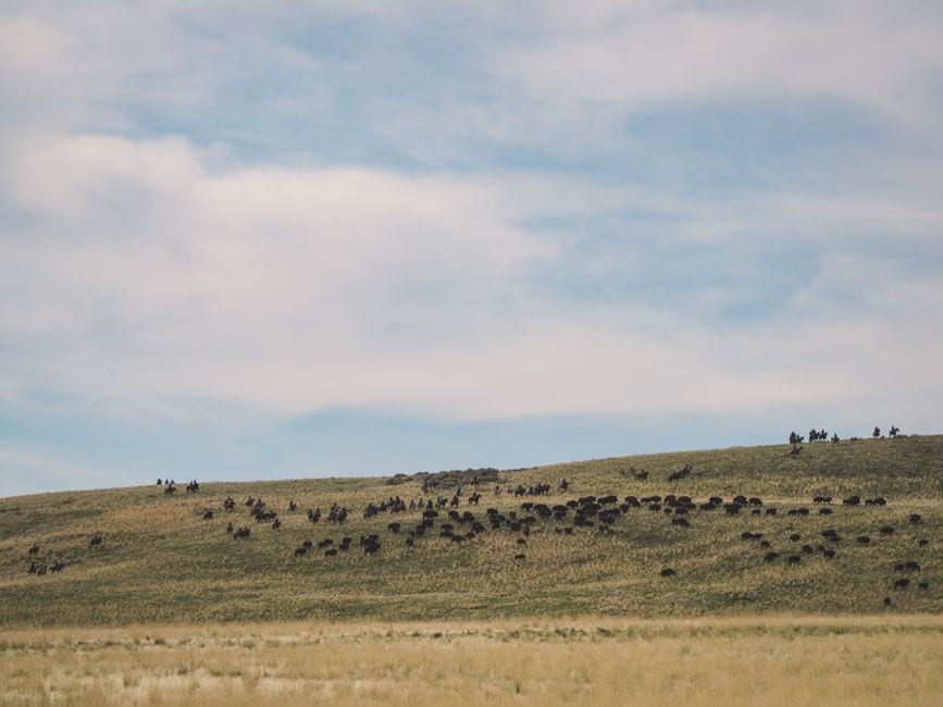 Illustrative image of American bison on open grassland; not the Texas State Bison Herd. Photo by David Solce on Pexels |
Some of Those Buffalo Came Home
In 1878, Mary Ann Goodnight urged her husband, legendary Panhandle rancher Charles Goodnight, to save several orphaned bison calves.
Those animals became the nucleus of the Goodnight Herd at the JA Ranch and eventually numbered more than 200.
More than a century later, descendants of that herd were transferred to Caprock Canyons State Park.
Genetic testing found rare characteristics linking the herd to the historic Southern Plains bison.
Today the Texas State Bison Herd again roams part of its ancestral range at Caprock Canyons.
A trip there offers something more meaningful than simply seeing buffalo.
You are looking at descendants of animals that helped define the ecosystem and human history of this entire region.
Water Changed Everything
For centuries, the Llano’s greatest limitation was not soil.
It was water.
Rainfall is limited and unpredictable, permanent rivers are scarce across much of the plateau, and shallow playa basins temporarily collect rainfall across the landscape.
Then settlers and farmers increasingly tapped the enormous store of groundwater beneath the High Plains.
The Ogallala Aquifer transformed agriculture on the Llano Estacado.
|
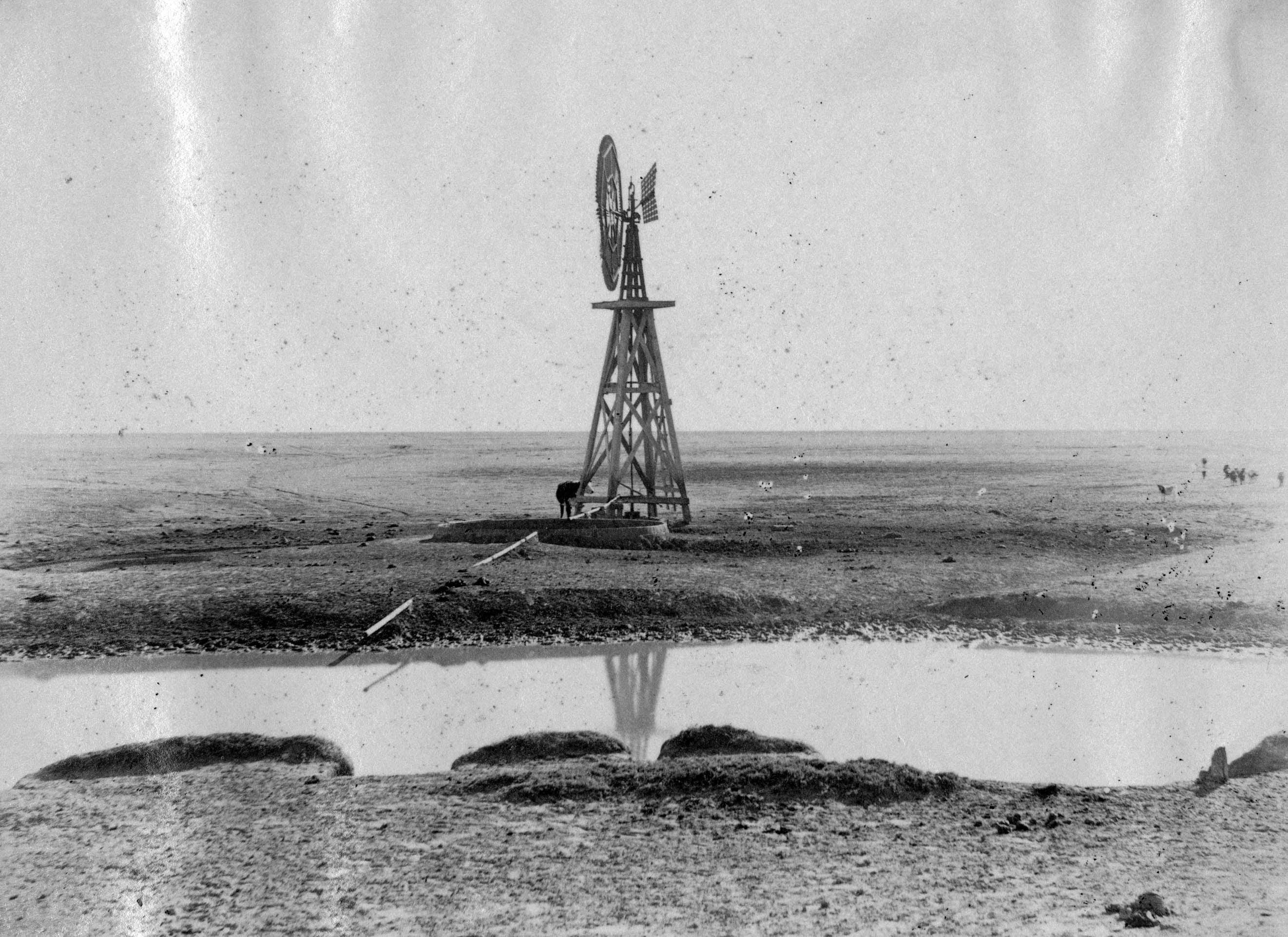 A stock-watering plant on the Llano Estacado at the XIT Ranch, circa 1902. U.S. Geological Survey image, public domain. |
With wells, windmills and eventually large-scale pumping and center-pivot irrigation, land once considered too dry for intensive farming became some of the country’s most productive agricultural country.
Cotton, sorghum, corn, wheat and other crops reshaped the economy of the South Plains.
That story continues today as communities wrestle with the long-term future of groundwater and the challenge of producing food with a finite resource.
The Landscape We Stop Seeing
Perhaps the strangest thing about the Llano Estacado is how easy it is to stop noticing it.
If you grow up here, flat looks normal.
The horizon looks normal.
The sunsets look normal.
Watching a thunderstorm develop from dozens of miles away looks normal.
Driving for an hour while barely turning the steering wheel looks normal.
But it isn’t ordinary geography.
We live on top of an enormous elevated table bordered by canyon country and escarpments, once covered by native prairie and crossed by vast herds of bison.
Spanish explorers struggled to navigate it.
The Comanche mastered it.
Ranchers occupied it.
Farmers transformed it.
And modern cities such as Lubbock grew in the middle of it.
The next time you drive outside the city limits and the horizon stretches almost perfectly straight from one side of the windshield to the other, take another look.
You aren’t simply looking at West Texas.
You’re looking across the Llano Estacado. |
0 Comments
Join the conversation
Be the first to comment
Share your thoughts above.